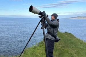
Anders Price – May 2021
Map: Belfair State Park; Theler Wetlands Trails; eBird: Belfair State Park; Theler Wetlands; Mason County
In the northeast quadrant of Mason County, the long waterway of Hood Canal makes a sharp turn to the east, nearly surrounding a little-visited, bird-rich landscape with stunning Olympic Mountain views (weather permitting). Bird highlights include possible Mountain Quail, close-up views of Pigeon Guillemots and Northern Rough-winged Swallows at their breeding hideaways, widespread Purple Martins, some Canada Jays and plenty of others. One lucky stop featured an American Bittern.
This trip makes a 57-mile loop beginning and ending at Belfair State Park, a few miles southwest of Belfair. That may seem long, but the birding stops described here are concentrated on a section of the loop making up half the distance, with stops every few miles. There isn’t much walking involved, but coming to and from Olympia/Shelton, you’ll pass the birding hotspot of Theler Wetlands each way, which makes a great leg-stretcher on the way home (see Bonnie Wood’s February 21 DIY trip report for info).
The directions are a little complex. Now that many of us are vaccinated against COVID-19, you might consider traveling with a copilot that can help with the point-to-point navigation.
Before the details of the trip, we must give thanks to local birder and Mountain Quail whisperer Mary Hrudkaj. This trip report would not have been possible without her generous guiding and shared knowledge. More about the quail whispering later.
The loop begins at the state park because it has the only non-primitive restrooms along the way. It also offers picnic tables, camping, and a short Hood Canal shoreline path. It’s a little over an hour from Olympia. From Olympia to the park, take 101 to the Shelton/Rt. 3 Exit. Take Rt. 3 through Shelton, making a right-left-right jog in downtown Shelton, and continue through Allyn and into Belfair. Going up through Belfair, look for a prominent Shell sign ahead, and turn left just before it, then left again at the stop sign almost immediately to get on Rt. 300. After about three miles, the park is on the left (Discover Pass required). Or, plug Belfair State Park into your navigation app.
To get to the highlights of this trip, you don’t need to stop at the park, and in any case you’ll have another chance to visit on the way back.
The first real stop is the Tahuya River estuary, 12 miles further west on Rt. 300, which turns into North Shore Rd. for most of the way. There’s parking on the left shoulder just before the river bridge, as well as on the edge of a large area that serves as a helipad in emergencies (also on the left), as long as you don’t mind driving through pond-sized potholes. During scouting on May 20th and 28th, Mountain Quail were calling from the surrounding cut-over hillsides while being overflown by Purple Martins, Killdeer were feeding on the short grass, swallows were swooping under the bridge, and Black-headed Grosbeaks were singing.
Next stop, continue on North Shore Rd. 4.5 miles to Menard’s Landing, at the estuary of Rensland Creek. There is a large parking area on the right, as well as a couple of spots on the shoulder. You’ll see a yellow “Road Narrows” and “Pedestrian Crossing” signs ahead just past the large lot and just before the shoulder spots. You’ll find picnic tables, a gazebo, and a kayak put-in. There is a short trail along the little estuary out to Hood Canal. We saw lots of swallows and a few Purple Martins here, as well as other birds.
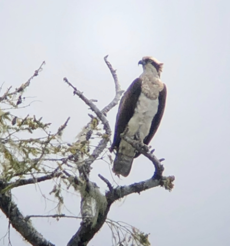
From Menard’s, return back 4.3 miles towards the Tahuya River on NE North Shore Rd. Turn left onto NE Belfair Tahuya Rd. In another .4 miles, turn left again to stay on NE Belfair Tahuya Rd. (rather than going onto NE Tahuya River Rd.). Within a mile, you will see Jiggs Lake on the right, and shortly an inconspicuous driveway entrance to Harvey Rensland Park, which has a view of the lake and a pit toilet. There is an obvious Osprey nest above the left shore, and an Osprey was patiently watching the lake from a nearby perch. Maybe another Osprey was on the nest.
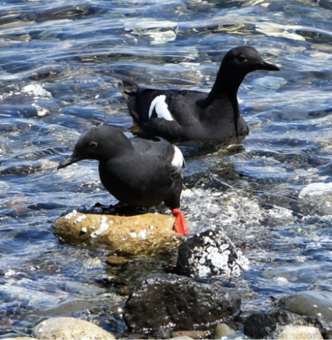
Back on NE Belfair Tahuya Rd., continue 2.8 miles to NE Dewatto Rd. on the left. Take it and continue 3.6 miles to the junction with NE Dewatto Beach Dr. There are some nice views of the Olympic Mountains along this stretch. At the junction, you’re facing the pretty Dewatto Bay and the Dewatto River estuary. Go left on NE Dewatto Beach Dr. It’s .8 miles to the dead end. Along the way there are pullouts for checking the bay and the clay banks above the road. Some of the banks have nest cavities and crevices harboring Pigeon Guillemots and Northern Rough-winged Swallows. The flock of Guillemots numbered in the 30s on one visit and offered some great views. On another visit, a pair of Belted Kingfishers was hover hunting in tandem across the bay, a spectacular sight.
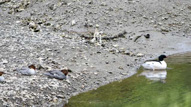
Return the .8 miles, but continue straight at the junction with NE Dewatto Rd., onto NE Dewatto Holly Rd. Most of this road does not have a phone signal. Look for a rough pullout .3 miles past the intersection, on the left just beyond a yellow “20 MPH” sign, where it is possible to walk on to the estuary flat for a look around. On one visit Common Mergansers allowed some nervous close ups, Band-tailed Pigeons were cranking their woofers, and an Osprey went by carrying a stick.
Continue on NE Dewatto Holly Rd. where you will shortly come to the Dewatto River Campground. It has river access, some portable toilets, and isn’t very busy midweek.
Continue past the campground for 1.5 miles, to a bridge over the Dewatto River. There is a pullout on the right for parking just beyond a “Narrow Bridge” sign. Dippers have been known to nest here, although we didn’t see one. The bridge is narrow, so keep an ear to the traffic, which is very light.
The next stop is tricky. Continue on NE Dewatto Holly Rd. 1.6 miles past the bridge. Look for the green “Mile 4” sign, followed by a yellow left-arrow warning sign. Look for an orange-gated forest road on the right with a patch of fresh, bright gravel where there is room to park (this whole area has a lot of orange gates). Directly across NE Dewatto Holly Rd., find a short trail to a view of Oak Lake. Swallows and Purple Martins were gleaning here, including from the lake surface. We also watched a pair of Common Ravens amble towards each other from opposite sides of the grassy area across the lake until they met and started nuzzling bills together.
Continue another mile on NE Dewatto Holly Rd. to a large shrubby meadow area on the right. Look for another orange gate on the left, which has a broad turn-around driveway with room for parking. A lot of birds were active here, where the Dewatto River oozes invisibly through the meadow. A Bittern made a lazy flight across the south end on one visit. Look for Hummingbirds, American Goldfinches, Western Tanager and Marsh Wrens. Virginia Rail has been reported here. At a pullout a short distance further along the road, on the right, the meadow view isn’t as good, but Canada Jays could be heard chattering as they passed by back in the woods, and a Swainson’s Thrush allowed itself to be coaxed into view.
Continue on NE Dewatto Holly Rd. 2.1 miles to a right turn onto Bear Creek Rd., which meanders for 1.8 miles over the Mason/Kitsap County line. There is no phone signal along this road. There is some wetland along here as well as some promising Mountain Quail habitat (they like the early stages of regenerating clearcuts, with lots of stumps and slash). Turn right onto NE Tahuya Blacksmith Rd. The parking area at this intersection has phone signal.
After 1.1 mile on NE Tahuya Blacksmith Rd., the blacktop ends, and you have a few miles of decent gravel road ahead. This section passes through some great Mountain Quail habitat in the logged areas, as well as offering Olympic Mountain views. Swallows and Purple Martins were flying over the stump lands, which at this time of year are brightened by lots of blooming rhododendrons and broom (if you can overlook its bad qualities), as well as the new green of the fir tips and red of the huckleberries. There is a small pond .8 of a mile past the end of the asphalt that can be good for flycatchers. A pair of skittish Wood Ducks also were seen here. Canada Jays have been reported in the more forested areas ahead. At about 2 miles there is a logged swath with some remaining large pines on the right that are worth a check.
At the green “Mile 3” marker, the gravel section ends at a tee. Go right to stay on NE Tahuya Blacksmith Rd. This is the end of our described birding tour. The road passes Lake Wooten and Haven Lake, which are pretty built up with homes and streets. A mile past Haven Lake the road hits NE Belfair Tahuya Rd. at a T intersection after passing through part of Tahuya State Forest. Turn left at the T. It’s 10 miles back to Belfair State Park. Turn left when you hit NE North Shore Rd. to head back to Belfair. The park is on the right if you want to stop there. The sign indicating the park is small; look for the wood rail fence on the right as you approach.
To return to Olympia from inside the park, go right on Route 300, right at the next two stop signs, and follow Route 3 through Shelton and 101 to Olympia.
Quail whispering: All that being described, if your main goal is a Mountain Quail sighting, you can contact Mary Hrudkaj to arrange a visit to her house. They frequent her garden and she welcomes birders. Her email address is mch1096@hotmail.com.
BEFORE YOU GO:
Before heading off for a birding adventure, here are some things to consider –
1. It’s always best to have a partner with you – both to maximize the joy and to minimize the risks. BHAS cannot ensure that these locations are totally safe.
2. Don’t forget to bring your mask and hand sanitizer. Have your mask handy and put it on when passing another person not in your party.
3. Leave valuables at home.
4. Check the weather and the bird reports before heading out. An easy way to check what birds have been seen is through Birder’s Dashboard http://birdingwashington.info/dashboard/. It is a simple way to research a species, place, or checklist.
