Paul Hicks – April 16, 2021
Map: Grays Harbor National Wildlife Refuge; Oyhut Wildlife Area eBird: Bowerman Basin; Oyhut Game Range
This scouting report from April 16, 2021, is for the Grays Harbor National Wildlife Refuge (aka Bowerman Basin) and Oyhut Wildlife Area (aka Oyhut Game Range), plus six additional sites in Ocean Shores and Grays Harbor County. The weather was spectacular but the birding was quite slow because migration won’t heat up for another couple weeks. Still I managed a day-list of 87 species, traveling 184 miles round trip from 10:30 AM to 8:45 PM. Following this chronological summary I share some tips for birding the coast.
Hoquiam Sewage Treatment Ponds (first visit, 12:00 PM-12:20 PM — see also second visit below)
Directions: Follow US101 and SR109 through Aberdeen and Hoquiam. Past the high school turn left onto Paulson Road. The ponds to the right/west of the “T” are more productive than the east pond which is being land-filled in.
Viewing/access: Most birds can be viewed from the wide shoulder while in your vehicle. Wheelchair and walker access along the paved, lightly traveled roadway is possible. The viewing from the opposite side of the ponds offers better light but requires walking on rough surface. Scope recommended, especially for shorebirds.
Bathrooms: No facilities here, but a short distance further are porta-potties at the refuge trailhead, April 20-May 11 only.
Sightings: No shorebirds because of the high water level (it’s lower in the fall) but there were lots of ducks. The most numerous species here and elsewhere were Gadwall and Northern Shoveler plus a good number of Green-winged Teal, Mallards, and Lesser Scaup. The thickets and woodland edge hold a variety of passerines: sparrows, wrens, and warblers — the numbers and diversity of the latter will greatly increase during migration. (See eBird for checklist and bar graphs for this hotspot.)
Most interesting sighting: A perennial Osprey nest along Paulson Road.
Point Brown Jetty, Ocean Shores (1:00 PM-2:30 PM)
Directions: Continue to Ocean Shores via SR109 and SR115. In Ocean Shores take the first left onto Point Brown Ave. Continue south at the roundabout and turn right after 1 mile onto Pacific (or after 2.4 miles onto Taurus.) Follow Ocean Shores Blvd to the southern tip of the peninsula. There is ample parking at the beach and jetty access. I figure 15-20 minutes from the car to the tip of the jetty (with caution!!).
Viewing/access: In addition to sandy beach and surf, the breakwater and jetty offer an excellent sea watch vantage point across Grays Harbor to Westport and open ocean. Scope highly recommended if one can manage it safely when clambering on the rocks. No wheelchair access.
Bathrooms: Several porta-potties, including ADA ones, are conveniently located at the parking area.
Sightings: The headliner for the jetty is “rockpipers.” I estimated 60 Surfbirds and 40 Black Turnstones. Too early for Ruddy Turnstone and Wandering Tattler; I did spot one late-departing Rock Sandpiper at another location, a pleasant surprise. Not much else was happening: cormorant and gull numbers were low; Western Grebes were most numerous and a few close-in Red-throated Loons were nice. (See eBird for checklist and bar graphs for this hotspot.)
Most interesting: A Dark-eyed Junco on the jetty. I’ve seen any number of surprises on the jetty: Golden-crowned, Song and Fox Sparrow, Golden-crowned Kinglet, and (best of all) Snowy Owl.
OYHUT GAME RANGE – Directions below
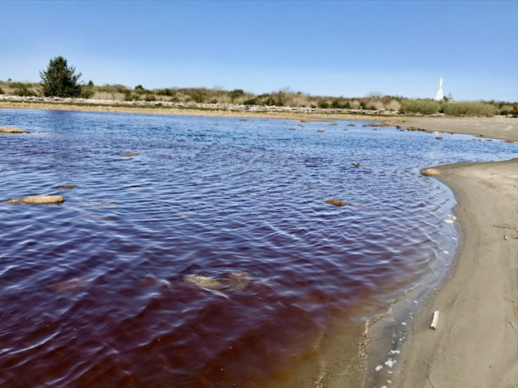
Popular among birders and duck hunters, dog walkers and beachcombers, the 683-acre Oyhut Wildlife Recreation Area (aka Oyhut Game Range) includes shoreline and semi-sheltered bay, dune grass and tidal ponds, with an expansive Salicornia marsh. The preserve is transected by a narrow but deep channel. One half is accessed from behind the sewage treatment plant; the other half from Tonquin Street. During migration impressive numbers of waterfowl and shorebirds — especially during high tide — are attracted to the refuge. Some seasons (mostly in the fall) Oyhut has hosted such rarities as Lesser Sand-Plover, American Golden-Plover, Ruff, Buff-breasted and Stilt Sandpipers, and Chestnut-collared Longspur. (See eBird for checklist and bar graphs for this hotspot.)
Each year winter storms alter the character of the dunes and ponds. Right now it looks like a gigantic bulldozer pushed all the driftwood off the dunes and piled it along the inland shore of the tidal pond. Gone is the mucky marsh-grass that one had to slog through coming off the Tonquin access; now it’s all filled in with sand (no rubber boots needed!). Foot traffic on the preserve is increased due to the surrounding development. (Note: My impression is that this site attracts fewer shorebirds than before, perhaps because winter storms have gradually degraded the habitat).
More information
Birding Oyhut and Ocean Shores: https://wabirdguide.org/south-coast-2/
Also: https://graysharbor.cleverneighbor.com/conservation/a-visitors-guide-to-enjoying-the-oyhut-wildlife-recreation-area/
Oyhut Game Range, access via sewage treatment facility (a & b)
Directions (a): Continue south/east on E Ocean Shores Blvd; turn into the Ocean Shores sewage treatment facility and park outside the gate. (The place is closed to the public during the pandemic.) A trail skirts the rock berm and circles to the rear of the fenced facility to the breakwater and adjacent sheltered cove.
Directions (b): Instead of turning into the STP, continue past the facility and park in the grass triangle near the first house on the right (see the solar panels). The trail skirts the fenced property and continues into the game range through dune grass to the shore. Follow the shoreline to the left toward the dunes and pond, about two-thirds-mile distant.
Viewing/access: This is an ambitious hike (I skipped it), sometimes rewarding, with views and habitat similar to the Tonquin half (see below).
Oyhut Game Range, access via Tonquin Street (2:45 PM-3:45 PM)
Directions: From the jetty and sewage treatment plant continue east/north on E Ocean Shores Blvd and follow Sportsman back to the main road, Ocean Shores Blvd. Turn right/east onto Marine View Drive, and turn right onto Tonquin St just past the new Oyhut Bay Market. There is ample parking at the gate; Discover Pass required. (More visible parking is available further along Marine View Dr, across from the water tower, but the hike in is considerably longer.) Pass around the gate and look for the “white” trail around the white aviation beacon; a generous swath is cut through the otherwise impassibly thick brush to the pond and dunes.
Viewing/access: The Tonquin half of the refuge is the better choice, though considerable walking — up to a mile or more — is required to access the various habitats. In addition to the pond and surrounding Salicornia and dunes, one can scope out to the mouth of Grays Harbor and beyond the tip of Damon Point. No wheelchair access.
Bathrooms: There are no facilities at this site.
Sightings: During my visit, the pond held good numbers of puddle ducks, mostly Gadwall and Northern Shoveler; Mallards, Green-winged Teal and Northern Pintail were also present. A single Greater Yellowlegs was the only shorebird. (During peak migration I would expect peeps, dowitchers and plovers, and Pectoral Sandpipers in the Salicornia in the fall.) Out in the bay were Surf Scoters by the dozen and a few Common and Red-throated Loons and Western Grebes. Several cormorants and gulls were resting on the half-submerged breakwater that helps shelter the bay. In the bushes back at the parking area were Rufous Hummingbirds, sparrows and towhees, and a Purple Finch singing in the distance. (Again, see eBird for checklist and bar graphs for this hotspot.)
Most interesting: An adult Bald Eagle flew over, ignoring the agitated ducks below.
Bill’s Spit (3:45 PM-4:00 PM)
Directions: Skipping Damon Point and the marina, cross the bridge on Tonquin, turn right/south onto Point Brown Ave, turn left/north onto Discovery Ave, turn right onto Catala Ave at the Interpretive Center, continue past the community center and turn right onto Duck Lake Drive, right onto Wakina Loop, right onto Mariner Ct and park at the barrier. (Note: The trailhead to Bill’s Spit is located at the end of the next turnoff from Wakina, Peninsula Ct.)
Viewing/access: The main attraction here is the view of Bill’s Spit where gulls, terns and shorebirds large and small huddle as the tide rises. One can also scan the north side of Damon Point and the sheltered waters of Grays Harbor’s North Bay for shorebirds, loons, grebes and waterfowl. The paved residential cul-de-sac provides wheelchair accessibility without the hike out the trail (recently reopened). Scope recommended.
Bathrooms: There are no facilities here. The closest bathrooms are back at the Interpretive Center if open (Catala x Discovery), at the grocery store or restaurants in Ocean Shores, and the public restrooms at the tiny Oyhut State Park in north Ocean Shores (SR115 at Short Cuddy Ave, Discover Pass required).
Sightings: As expected I found the Marbled Godwit flock, plus Dunlin, Short-billed Dowitcher, and Black-bellied Plover. (See eBird for checklist and bar graphs for this hotspot.)
Most interesting: Besides the godwits, a gorgeous Red-breasted Merganser drake flushed and flew a lengthy full loop right in front of me.
Burrows Road (4:15 PM-4:30 PM)
Directions: From Bill’s Spit continue north on Wakina Lp, turn right/north onto Duck Lake Dr; after 2.8 miles turn left at the airstrip onto Albatross, then right onto Chance A La Mer which goes back to Ocean Shores. Return to SR115 and SR109 toward Hoquiam. After 2.5 miles, turn right onto Burrows Rd. This route parallels the highway and rejoins at the Humptulips River.
Views/access: Look for any number of pull-offs, even on narrow shoulders, which offer views of the north shore of North Bay of Grays Harbor, including a lovely, grassy estuary near an oyster operation. The road also passes through cranberry bogs, tidal sloughs, conifer woods, and deciduous bottomland. Because there is little traffic, wheelchair and walker access is possible with caution but much birding can be done from your vehicle. Scope recommended.
Bathrooms: None.
Sightings: A few groups of Dunlin and Greater Yellowlegs at the estuary. Finches and blackbirds at a home with feeders. Surprisingly no eagles today, and few waterfowl in the bay. (See eBird for checklist and bar graphs for this hotspot.)
Most interesting: Several Pacific Wrens singing enthusiastically as I drove past.
GRAYS HARBOR NATIONAL WILDLIFE REFUGE – Directions below
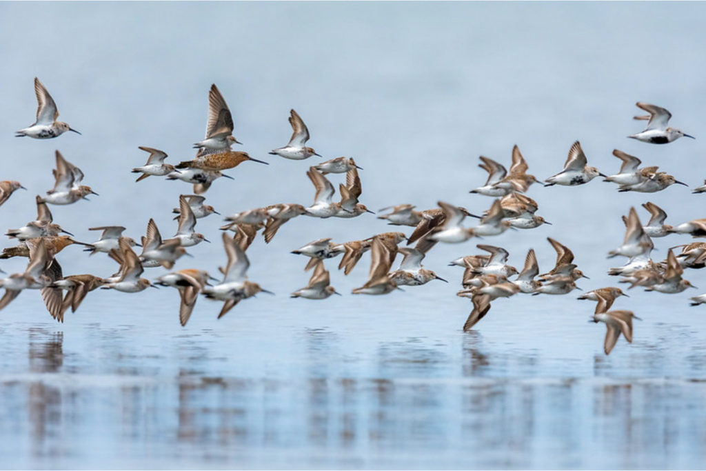
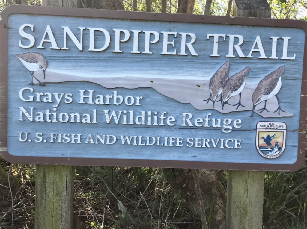
To protect crucial shorebird habitat, Congress authorized the establishment of Grays Harbor National Wildlife Refuge (aka Bowerman Basin) in 1988. Managed by the U.S. Fish and Wildlife Service, Grays Harbor NWR encompasses about 1500 acres of intertidal mudflats, salt marsh, and uplands including what is known as Bowerman Basin. It is one of four major staging areas for migrating shorebirds in the Pacific Flyway. Most of the world’s population of Western Sandpipers move through Grays Harbor estuary, where they will spend two to five days to “refuel” for the next leg of their journey.
In late April and early May nature enthusiasts flock to the refuge to witness the shorebird migration spectacle. The “Sandpiper Trail” provides close-up views at high tide of the basin’s mudflats where the shorebirds congregate, while passing through wetland and woodland that hold numerous migrating and nesting songbirds. The wheelchair accessible trail is about a mile long, half pavement and half boardwalk, with several viewing benches to rest along the way. Allow about two hours for a leisurely pace, plus birding time. The trail is open year-round, sunrise to sunset; no pets allowed. Porta-potties will be available at the parking area April 20-May 11 only.
An annual favorite is the Shorebird and Nature Festival. This year’s festival is April 24-30. Because of the pandemic, the events and presentations will be virtual and accessible at the festival website: http://www.shorebirdfestival.com
More information:
Refuge: https://www.fws.gov/refuge/Grays_Harbor/
Phone: (360) 753-9467
Best viewing times (8.7 ft high tide is optimal): http://www.shorebirdfestival.com/viewing/viewing
Festival email: shorebirdfest@gmail.com
Grays Harbor Audubon Society: http://www.ghas.org/
Grays Harbor Wildlife Refuge (4:45 PM-6:30 PM)
Directions: Just outside Hoquiam turn off SR109 onto Paulson Rd (note the sign to the refuge). At the “T” turn right/west on Airport Way and proceed along the sewage ponds and airport to the parking area at the gate.
Views/access: The wheelchair-accessible “Sandpiper Trail” first passes between the airport hangars and the grassy wetland fringed with willow-alder thicket — all great habitat for sparrows and towhees, Bewick’s and Marsh Wrens, chickadees and bushtits, Rufous Hummingbird and Warbling Vireo (in season), and a variety of warblers during migration: Yellow-rumped, Orange-crowned, Wilson’s, Yellow, and Common Yellowthroat. Beyond the paved section the boardwalk begins, passing through willow and alder woods and eventually out to the edge of the expansive mudflats of Bowerman Basin where the shorebird spectacle occurs. Scope recommended. (Walking swiftly, it took me about 20 minutes to get out to the end.)
Sightings: Marsh Wrens serenaded me nearly the entire route (yellowthroats had not yet arrived). Savannah Sparrows were prolific on the airport grass, while Song, White-crowned Sparrows and Golden-crowned Sparrows dodged in and out of the thicket. I arrived at the mudflats right at high tide, but the few shorebirds were feeding at considerable distance because the tide was a foot lower than the optimum 8.7 feet. So the tide, the migration calendar, and other factors make a huge difference in how closely the shorebirds approach the boardwalk. Instead of the masses of peeps, plovers, dowitchers, and (in early May) Red Knots, I saw a handful of Black-bellied Plover, Dunlin, Short-billed Dowitcher, and Greater Yellowlegs on the mudflats plus three Whimbrel in the grasses. In the shallows were Green-winged Teal and Mallards along with a surprising Common Loon. A large flock of Pintails loafed on the opposite shore.
Most interesting: Twenty Bonaparte’s Gulls mixed with flocks of Caspian Terns and other gulls resting on the shore. I have only seen Bonaparte’s Gulls two times before in spring out at the coast. Also, a late-departing Fox Sparrow popped out of the bushes back near the parking lot.
Hoquiam Sewage Treatment Ponds and Shoreline (second visit, 6:30 PM-7:00 PM — see first visit above)
Directions: Backtrack on Airport Way to the ponds. Continue east and around the ponds to the shoreline side. (From here I follow the truck route east through west Hoquiam.)
Views/access: The lighting is more favorable from the south side of the ponds, but they cannot be viewed from your vehicle. Also, the northernmost pond that attracts sandpipers in the fall is viewable only from the north side. However, the shoreline and east extremity of Grays Harbor, though usually not particularly productive, can be viewed from here. Large numbers of gulls and terns congregate at this location at certain times of the year. Scope recommended.
Sightings: After a second check of the ponds, I made a quick stop to scan the shoreline since the tide was still up a ways. Beneath the huge pier I spotted my only Least Sandpipers and Semi-palmated Plovers for the day.
Brady Loop (7:20 PM-7:45 PM) – See the January 20th DIY for information on this stop
(See eBird for checklist and bar graphs for this hotspot.)
Most interesting: A single Snow Goose with a flock of Canada Geese.
Pond at Fish & Wildlife Hoxit Unit, near 6060 Hwy 12 (8:00 PM-8:10 PM)
Directions: Continue 8 miles on Hwy 12 out of Elma. The gravel track down the road bank to the pond is difficult to see if you don’t know it’s there.
Views/access: This may be the only of the several ponds and wetlands along the highway that has public access. Puddle ducks and Pied-billed Grebes frequent this spot in season; raptors hang out along the edges; passerines migrate and nest in the surrounding woods. Great Egrets have been reported here.
Bathrooms: None
Sightings: I added Wood Duck, Wilson’s Snipe, and Common Yellowthroat to my day list before nightfall.
Most interesting: Four Wilson’s Snipe.
Paul’s tips for birding the coast
My idea of the perfect birding trip to the coast is to visit as many sites and find as many species as I can. This requires considerable advance preparation in order to maximize the long trek out there and distance between stops. Here’s my approach, whenever possible.
Identify my targets: I check Tweeters and eBird to see what interesting or unusual birds are being reported, or can fill out my year list.
Learn the sites: The Washington Ornithological Society has the state bird-finding guide online for free!! For the best sites with directions and interesting/target species, visit https://wabirdguide.org/ . (Real Estate offices often have good maps of Ocean Shores.) It’s also good to know where the bathrooms stops are. 🙂
Pick a good day: If I have flex in my schedule, I look for days with favorable weather. Overcast is fine but I avoid rain and high wind. I also try to avoid weekends and, in the fall, I wait until school starts.
Time the tides: I plan my itinerary according to the tides. Generally hit the jetty at low tide (when venturing out toward the tip); visit Bottle Beach or similar sites on the incoming tide (starting at around 5.5 feet at Bottle Beach, about 2 hours ahead of high tide). I calculate how long it takes to drive from one site to the other, and often budget my time at each locale accordingly (but rarely keep it!). The optimal day: long daylight hours with two high tides, covering from Ocean Shores to Tokeland. For tide and weather information at multiple locations, one source: https://www.tides.net/washington/
Time the migration: For shorebirds, late April to early May in the spring; August through early October in the fall. The Washington Ornithological Society has bar graphs that show when migrants can be expected (https://wabirdguide.org/bar-graphs/); and Marv Breece has compiled similar info for shorebirds (and other species), juvenile and adult (see https://wos.org/documents/Occurrence/ ). I take printouts of this information with me.
Pack food & drink: When I’m in “bird binge” mode, I don’t stop to buy gas or food. I pack it all with me.
Dress (depending on the conditions): wind-cutting/water-proof layers, rubber boots, rock-jumping boots with both support and cushion (and ibuprophen!), gear that allows hands-free mobility on jetty, umbrella, billed cap, sunscreen, sunglasses, spare glasses in case of spray, soft cloth wipes for optics…
BEFORE YOU GO:
Before heading off for a birding adventure, here are some things to consider –
1. It’s always best to have a partner with you – both to maximize the joy and to minimize the risks. BHAS cannot ensure that these locations are totally safe.
2. Don’t forget to bring your mask and hand sanitizer. Have your mask handy and put it on when passing another person not in your party.
3. Leave valuables at home.
4. Check the weather and the bird reports before heading out. An easy way to check what birds have been seen is through Birder’s Dashboard http://birdingwashington.info/dashboard/. It is a simple way to research a species, place, or checklist.
