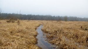
 After six years of hearings and litigation, the Washington State Court of Appeals denied a Hearing Examiner’s approval of a Special Use Permit (SUP) for Quality Rock Products (QRP) for an expanded gravel mine, asphalt plant, and concrete plant adjacent to the Black River National Wildlife Refuge a few miles south of Black Hills High School. Since 2001, BHAS has been arguing that it is inappropriate to have an industrial operation on the border of a unique riparian ecosystem that is home to rare wetland plants, spawning coho, and the Oregon Spotted Frog (now a threatened species under Federal law). In 2007, the Appeals Court agreed with appellants Thurston County and BHAS. The Court focused its conclusion on the need for more water studies, saying “Missing from this analysis, however, is any assessment of this withdrawal’s effect on the Black River’s flow volume, particularly during the peak production, dry summer months.”
Alas, in 2009, QRP reapplied—this time for mine expansion and a concrete plant. In September 2017, QRP submitted final technical groundwater and mitigation reports, the last requirement to complete its application. Jim Mathieu, the hydrologist for BHAS, quickly submitted BHAS’s response. Water is our key environmental argument. BHAS has recommended several reasonable ways to greatly improve QRP’s analysis of mine impacts. These recommended analyses (additional model scenarios) would better inform the monitoring and mitigation necessary to protect the nearby aquatic habitat. To date, QRP has not directly acknowledged BHAS’ recommendations or comments.
BHAS’s two requests are (1) that QRP run computer models now for conditions where the mine excavation pit lakebed is less effective than QRP assumes, and (2) use the model results to equip select monitoring wells and creek stage gages with computer sensors both on and near the mine site. QRP has already installed monitoring wells, but they only take water-level samples at each site every three months and have no plans for continuous data collection. Computer sensors in wells and at creek stage gages provide much more reliable data by registering water levels continuously. With respect to point 1, BHAS is also concerned that disturbing the lakebed sides and bottom layer during on-going future excavation over the life of the mine would damage any protective lakebed silt layer. QRP suggests this protective silt layer would mitigate the altered water-seepage pattern from wetlands, streams and groundwater caused by the artificial lake. BHAS also questions the assumptions upon which the stated rate of lakebed silt-layer development is based.
Geoengineers, a consultant group retained by Thurston County, will examine the QRP groundwater memo and mitigation. If they agree with QRP, the State Environmental review (SEPA) and SUP land use hearing may take place in late fall or early winter. (by Sue Danver, photo Capitol Land Trust – Jodie Dubois)


